Category Archives: WHERE 2.0

WHERE 2.0, Wednesday, Final

Presenter from Bitly announced  as “she will share pure geo porn”

bitly by Hilary Mason Chief Scientist

time == f(space) or more precisely, time == f(distance) now, with Twitter, time == f(attention)

2h of Twitter to be clicked. 7h on Youtube to be clicked. Egypt stats shown Internet down, revolution clearly. Bitly has clicks. All theis data is generated by clicks. They have time too, hence they analyze real-time clicks. Social data and Location data are noisy filters. New geographies of social data. Plus time.


Closure panel.

from WHERE conferences, the trend was from ‘how to collect data’ to ‘how to make impact’. what is a biggest surprise at WHERE this year? or biggest unsurprise? people are changing behavior based on biolocation data. 2-3 next years. by Waze. Smart cities. Sensors. M2M between the phone and building. Cities will have API. Interplay of different kinds of sensors is exciting. By Bitly. Voice interface to reduce cognitive load during interaction. By VC. greater and smarter context. Time to build new innovation. People assuming that current model would stay (e.g. search). Current search paradigm makes any sense in my device. Need ‘smartness’. BodyMedia mentioned when talked about smart things. realtime exchange. what you context will be along the way in real-time? mobile phone is trusted identity. but losable, stealable. solve the problems for the real people, make them come back. foursquare, yelp, facebook, twitter – generates data from what users put on top of it. Apple has a clear biz model of selling devices. Do you own your own data? facebook is not a geopower house. next geopowerhouse will be social. twitter is on the list. eBay is interesting with recent acquisitions of RedLaser, Milo.


my conclusion. WHERE 2011 was stronger than WHERE 2012.


Tagged , , , ,

WHERE 2.0, Wednesday, Part III – Native vs. HTML5

Zaarly http://www.zaarly.com

5,000 year old idea.
Post a request and you will be connected with someone who can fulfill it. Pay only when you get the goods. Tell us what you want to sell you will be notified at anytime 
someone asks for it. Now building an environment for safe buying and selling with the people. It is meta-market place. Crazy doesn’t work, but if you ask smth sane, it works. Ask what you want, how much you can pay and the work will be done by somebody near you. Some similarity to TaskRabbit + craigslist

In few days 10K dollars came in transactions on daily basis. Product has been changed since that time. Product became ‘on-purpose’ instead of being ‘the neccesity’. It was native iOS app. After 2 weeks such questions as HTML5 raised! After year HTML5 won in terms of deployment, supporting iPhone and Android.

first 3 months of decision making. Why we did native deploy? why now we do HTML5?
who uses iPhone native Facebook app today?!

Issue with UX exists. There is same Tab Bar on top of the screen on both iPhone and Android. For Android it is OK, as conformant to the Android UI guidelines. But for the iPhone it is a style problem. Apple HIG specifies Tab Bar to be at the bottom. Hence, Mobile Web doesn’t work is you want to be conformant with every platform 100%. Having two codebases (one for Android, one for iPhone) is a solution, it is known as Dedicated Web. Almost same code, but different positioning of the Tab Bar (and other specific elements of UI that are religiously different). Or, brand you bar, use it always at same place and f..k guidelines.

Tagged , , , , , , ,

WHERE 2.0, Wednesday, Part II – Healthcare & Location

Healthcare session

INTRO highlights from four panelists.

Geomedicine is emerging. Location data needed “to make medical records more enriched”. Environment is a critical player, environment is related to the geography significantly. New medical framework needed.

Place information to be brought into the story. Bring mobility into the story, as a location traces. Location over time (physical activity) matters. How I communicate chronical disease. Traces of daily lives. Pulling features out of daily traces. Looking for standardised platforms to use. Looking for mobilized innovations in healthcare.

Intersection of mobile activity data to deconstruct human genome why people do and how they do. Get data from telecoms, twitter, facebook and analyze the data. Track diseases from social and location networks. Incorporate into doctors’ diagnosis tools.

Tools for healthy behavior changes. How tools change daily behavior patterns. Places, environment, time etc matters. How to utilize technology in healthcare. Location data seems very attractive for unlocking hidden patterns in disease and people data.

APPLICATIONS of new approaches to healthcare.

Eating. If smbd prohibited to eat fast food, the app will discover smbd goes to Taco Bell and warns to not eat there. May be app will tell the doctor about that patient violating the rules of nutrition. Therapy tools. Tools keep track and make recommendations. Tool knows you spent 5h in shopping mall and how it affects insomnia. There are 20,000 toxic places in the states. 10M pounds chemicals per day produced… it is issue for environment. Public health. You are informed, you make decisions. Further: how we bring other specific points of data into the framework?

BARRIERS in geomedicine

Privacy in healthcare is a huge barrier. Overwhelm with information. He-he, BigData comes to healthcare:) Sensemaking out of the data. Profession of data scientist comes to healthcare. Ecosystem needed.

OPPORTUNITIES

Location is an opportunity. In long term – understanding human activity at the level of context to encourage doing smth. Change people awareness, people attitude. Autonomous tracking of behavior patterns. Sensors do not really working. Where do you go? Whom you contact with? You can understand people, their health related behavior. E.g. if you eat in front of TV, how often do you eat home, how
fast do you eat, time of eating, gym facilities. Interventions are bound to the context – what exactly to push to the patient. In-door locations within hospitals and clinics. Geodistance of your day. Those things impact medication. analysis of daily and weekly traces give answers. Parkinson disease is location specific. Self-diagnosis via summarizing information. For medical tools: “one size does not fit all anymore”. Different personalities, research done.

CONCLUSION

conclusion for mHealth – Public Health, Disease Management, Mobile EMR confirmed and distinguished categories (from other ~10 categories) as mHealth solutions.


Tagged , , , , , , , ,

WHERE 2.0, Wednesday, Part I

So, second day of the conference. Looking for some interesting keynotes.


News through Data by Jer Thorp
Data taken from Kepler project by NASA, search for exo-planets.
Cool video demo http://vimeo.com/19642643
Back to the GPS path, shown last year, from hidden file on iPhone https://openpaths.cc/
you can propose a project there https://openpaths.cc/projects


SAMASOURCE http://leilajanah.com/samasource/
by most beautiful speaker so far Leila Janah
Photographers woke up when she came on to the stage.
Idea is that data projects devided into small pieces. Sample is handling of POI data tasks. Project management in San Francisco. Work in Africa @ $1-3 per hour.

her conclusion: “take messy data, address poverty”
my experienced friend’s conclusion: “too expensive dress for that presentation”


Geoloqi
Platform for real-time location, messaging, and analytics https://geoloqi.com
Geofencings, location based analytics, location tracking. Geofencing solution is battery safe https://developers.geoloqi.com/features/geofencing
Brand new game, powered by Geoloqi – play on real territory http://mapattack.org. Two teams compete to capture the most points on the gameboard. The gameboard, in this case, is the city streets of the neighborhood the players are in. To play, all you need is a phone, a city street, park or college campus, and some friends.


Kullect http://www.kullect.com
Capture things that interest and inspire you from the real world. Organize your posts into “kullections” based on topics. Discover what your friends are sharing and what’s nearby. Share and discover. Creators, curators. 1st place from ~10 startups.


Gaming Reality
by Will Wright.
A lot of slides, a lot of words.  Conclusion is to build unique experiense for person and environment. One more confirmation for personal UX.


URBANSCALE http://urbanscale.org
~14,000-year history of mapmaking
inventions and discoveries of new maps, artifacts etc.


OBLONG http://oblong.com
Remember “Minority Report” movie? The technology has advanced. MIT Media Lab “Minotirty Report” –> Boeing Saudi Aramco –> Mezzanine g-speak SDK. The g-speak SOE (spatial operating environment) is Oblong’s radically new platform. The SOE made its public debut in the film Minority Report, whose bellwether interface one of Oblong’s founders designed. But its full history extends backward
to three decades of research at the MIT Media Lab. video demo http://oblong.com

Mezzanine demo. Move objects thru the meeting room (space). Seems the objects then could be drug’n’dropped between ALL devices in the room (thru the space) like iPap, laptop, phone.

live demo with Kinect, by Pete and Tom. Tracking hands and FINGERS by Kinect. Shown in Mac screen put vertically:) Control by the phone as by remote control unit to the TV. If there were other screens (or projection devices), they are all within the “space” and content from one screen could be thrown to another screen smoothly.
and “we are hiring” at the end…


Wireless Stars
ex-Google
buiding Egypt 2.0

LBS used to build Egypt 2.0
IntaFeen http://www.intafeen.com is a foursquare for Arab world. Culture translation. IntaFeen was used during revolution and after the revolution. crowdsourcing everything to plant trees, police, repairing, cleaning. OneYad – connects people based on interest & location. OneYad means one hand. From social networking to social working http://oneyad.com

BTW OneYad shows why Facebook sucks for everything else except sharing.


Google
by Brian McClendon, VP of Google Geo, former Keyhole founder http://en.wikipedia.org/wiki/Brian_McClendon

Ingredients of Modern Map Service
* sub-meter imagery (see smbd’s house)
* aerial imagery
* increase in OBLIQUE (what is that?)
* historical imagery (before vs. after)
* street view imagery (only 5 cities in 2007. now 35 contries.)
* apls and amazon rainforest (camera on top of the train and the boat:))
* unique problems (frog on the camera lens)
* art project (151 museums, indoors rock)
* Japan, tsunami… the only way to see how city looked before tsunami is Google
* Maps older images…
* vector data (with plenty hidden data). Internal tool for editing and debugging
* 20 countries with streetview
* map maker, empower users
* users share: “there is a field of marijuana here” and pin on the map
* 1.6M QPS peak tile serving, 75ms avg tile serving latency, 99,995% avail over 3y
* API, geocoding, directions, places, street view
* Dynamic tiles, for enabling dynamic features
* recap: IMAGERY, VECTOR, DELIVERY
* future is 3D

Brian’s conclusion for future: “it will be 3D”.
my conclusion: “all those free maps are far away from Google… Google is a growing monster”

Tagged , ,

WHERE 2.0, Tuesday, Part V

To Google or not to Google?
by StreetEasy http://streeteasy.com
dilemma between use of commercial map provider vs. free alternatives

web map stack (also useful to other non-map imagery delivery):
* map viewer
* tiles
* serving
* raw data
* style
* markers & layers

StreetEasy stats
20,000,000 pageviews per month
600,000 map views oer day
$2,300 per day in Google fees
$850,000 per year in Google fees
20x our current hosting fee

is OpenStreetMap is an only option? do we want to put them on the site?
Stamen, people enjoy them!
TileMill from MapBox.
CARTONDB.

made our own maps!
maps have own set of tradeoffs.

data from OSN, NY City CUNY and ourselves,
Own tile design using TileMill,
hosted and served on MapBox,
viewed in Leaflet.
1.5man/month.
$15K-20K per year.

never use Google maps for all-paid site (enterprise license).
http://switch2osm.org
http://mapstraction.com as a Plan B is rules change.

Tagged , , , , , , , , ,

Twitter Geo Stack

Twitter geo stack

p20120403-142217

Gazetter architecture at Twitter

p20120403-142523

Scala at Twitter

p20120403-142326

Raffi, Director of Platform Services

p20120403-142638

Tagged , , , , ,

WHERE 2.0, Tuesday, Part IV

Twitter Geo Stack

Twitter

@RAFFI Director of Platform Services from Twitter presented their geo stack.
at high-level Twitter’s geo infrastructure looks like this:
* Ruby in Rails frontend
* Scala-based “Rockdove” service using JTS
* Cassandra as the persistent store
* Thrift as RPC mechanism

There were details about the data format for Cassandra (place, edit and id), index nodes sharded by place id, Lucene used for search. There is Gazetter component interacting with Indexes. Gazetter is also connected to Cassandra.

my question was “what was a consideration to prefer Cassantra to MongoDB or HBase?”. The answer was “it is historical, at Twitter it Cassandra is historical. There are 5-6 Cassandra committers. So it’s historical.”

Tagged , , , ,

WHERE 2.0, Tuesday, Part III

In-door navigation.

Meridian http://www.meridianapps.com
Hospitals, Home Depot. Powell’s Books. Navigation increased sales by $$$$$.
Apple doesn’t allow wifi scanning API exists but is “private”. App will be rejected for using it. Hence, everything works on Android only.
Bluetooth could be a solution for iPhone. Bluetooth devices distributed within the interior will communicate with iPhone, and by triangulation algorithm the indoor location is done.
“Blue Dot” problem. Accuracy is “room level”. Locations need control. In-door navigation is exciting. More companies adopt it. Meridian is a platform that helps.

Tagged , , , , ,

WHERE 2.0, Tuesday, Part II

continued after the coffee break


Noah Iliinsky on visualization with maps or without maps. No need to use maps everywhere! Is location information meaningful? it depends. The Genealogy of Pop/Rock music http://www.historyshots.com/rockmusic/. Religious borders and Linguistic borders. Geography is important and used properly. Council of Europe, European Union, Schengen Area etc not possible to show on geographical map, or even not needed to do it http://en.wikipedia.org/wiki/File:Supranational_European_Bodies.png. Famous Napoleon march diagram, contains almost now geography. Just couple of rivers http://en.wikipedia.org/wiki/File:Minard.png

BTW yesterday we had a discussion of famous Underground map (London Tube Map http://www.tfl.gov.uk/assets/downloads/standard-tube-map.pdf). Noah mentioned screwed geography (notice circles on background). I’ve brought the idea that the map could preserve the real proportions if more details added (much more details) that would emerge into the new map, totally next level of presentation in comparison to the current one. Hoping for “to clarify, add details”.


Kickstarter project Baloon Mapping Kit http://www.kickstarter.com/projects/1775485688/balloon-mapping-kits
Demo with aerial kit. Baloon with iPhone on the rope. Public Laboratory Mapping Tool. MapKnitter is used to combine aerial photos into the map http://mapknitter.org. Multi-spectrum imagery possible. This is really useful for example for agriculture.


Urban Airship http://urbanairship.com
Started with Bluetooth. Idea for messaging. Push notifications. Push is the savior for apps. Set of services for developers around push notifications. 1st generation of mobile apps – shown web on mobile. 2nd generation – receiving stuff in personalized way.e.g. Walgreens let’s you take the pharmacist with you. Adding location to this mix is tricky. Location is hard to get right in messaging. Segments. Precision audience targeting: location, context, preferences. Walgreens knows you will not run out. meridian – indoor GPS http://www.meridianapps.com together with Urban Airship.


Dwolla https://www.dwolla.com

The cash-inspired payment network What about indoor location?
payments are screwed up for programming for apps.
sending money should be easy as a single call to the API (single url).


SoLoMo http://slmtechnology.com/solomo/
collaborative consumtion. shared economy.
Social+Location+MObile == service networking


Tracking & Mapping Disease
real-life stuff about disease research by geography.


Tagged ,

WHERE 2.0, Tuesday, Part I

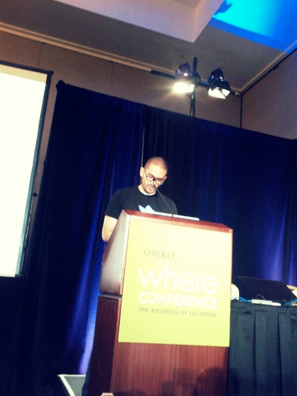
Monday was workshop day. On Tuesday the Conference has started. Below is a chronological summary with some details what I paid attention to.

Altimeter Group http://www.altimetergroup.com

Enterprises should think on strategy for 2-3 years in rapidly changed world. Online and offline worlds get connected. Hardware matters. RFID embedded into everything, shoe with RFID and Facebook deck for two to become friends http://www.wired.co.uk/news/archive/2011-01/27/rfid-shoes
Coupons for location-based shopping, based on previous experience (coupons sent based on shopping list). Interesting how Grouppon is going? last year they turned down Google 1.5B bid, florished at WHERE 2.0 2011… now things turned worse for them?
In retail shopping, in-store GPS maps the route in the store. You are get directed to your product.
Sentient world happens. World becomes smarter because of the data. Smart refrigerator. Smart gadgets, e.g. Fitbit. Pace adjusted for time not moving. Device is smart http://www.fitbit.com
Smartphone needs to get smarter. Smartphone could embed Fitbit and other functionality. Question is about miniaturization in time. Ok, how the smartphone can get smarter? Who do I talk with most? Respond to quickly or ignore completely. Prioritize contacts based of behavior. Add travel time based on my locations.

IN Google WE TRUST.
IN Facebook WE TRUST (?????).
IN Apple WE TRUST.

B2B Enterprise Apps Change Work. GE MyEngine App http://www.ge.com/audio_video/ge/products_services/myengines_app_debuts.html Enterprise mobile apps is the fastest growing area. Box OneCloud. Yammer Mobile. Enterprise Social Networks (ESN) provide context. Connection–>Collaboration–>Optimization–>Transformation. Enterprise Mobility Takes Various Forms. Corporate Info Access <–> Field Collaboration <–> Complex Computing

how to prepare to brave new world?
1. Formulation
2. Consideration
3. Commerce
4. Post-commerce

and it goes with Enterprise Mobility into next years.


MapBox http://mapbox.com

1,000,000 sites using Google Maps. Custom Maps – huge product differentiator. Or money saver on free maps? TileMill – open source design tool http://mapbox.com/tilemill/. There is API for integration. MapBox declares the stuff is really-really fast. Streeteasy.com switched from Google Maps to custom maps http://streeteasy.com. NPR switched too. MapBox Streets. Powered by OpenStreetMaps http://mapbox.com/hosting/api-embed/ Foursquare uses those maps too. If Foursquare uses free maps, then we also could use free maps. Goodbay Google Maps (or lower the price for us!). Alex Howard: “The Year of the Open Map” https://plus.google.com/107980702132412632948/posts/h8NWAJyzcAS. node.js gave incredible speed. This is not a first of second time I hear about node.js http://nodejs.org


ESRI
GIS as a service. S ome demo of some new API… ESRI is a sponsor. Bought time to show their new API for mobiles.


CARTIFACT http://cartifact.com

Responsive Design. Map is a communication tool. Information is modified to fit paper size or screen size. What is a context of using map? if navigation, then intent is clear. Speed is used to determine the level of detail. As well as content, data, color of information. If you travel by the car, another context data is needed, at block and house level. Vegetation according to the season is another content.

Locational exceptionality – specific features shown at specific location. 3D buildings in Manhetten downtown via lens over the high-level map. Or potential flood because of climate change. Paradigm is to be responsive to activity, time, location and device. Future is to discplay exactly what we need at the moment. Kind of personal UX.


Stratocam http://www.stratocam.com

Rediscovering satellite photography. Website for view in fullscreen mode. Idea is similar to the book “Earth from Above” http://www.amazon.com/Earth-Above-Yann-Arthus-Bertrand/dp/0810934957. Users vote for imagery and Stratocam scores the ranks for the imagery. Then best images are promoted. Focus is on composition, because there are not many colors like on sunset or zoo picture taken by SLR. Site is already integrated with picture-twitter Pinterest.


CONTROL GROUP http://www.controlgroup.com

Hardware geek from New York. Wi-Fi pings as physical “cookies” plus signal strength gives info. Other wireless devices listen to this info and analyze it. They capture data sets patterns. Man in the middle, CG established the interception of our phones and laptops… they store MAC, device manufacturer. Could be useful for stores to analyze the crowd.


Gowalla (now Facebook) http://gowalla.com
by Josh Willams
Location at Facebook: places in August 2010 –> location tagging got status & photos in August 2011 –> location tagging within hte Platform in March 2012.

Posts, search around location. Meaningful activity around geography. 200M users tag location on monthly basis. New tools for devs:
* improvement of place data quality
* Open Graph place objects
* place editing API
* geo-coding and reverse geo-coding service

Invited to “most modest booth” in the excibition hall. I’ve checked the booth. It is even worse than modest :-O


Tagged ,